
This railroad became part of the Chicago, Milwaukee & St. Paul in 1872. The CM&StP (Milwaukee Road) had already constructed a line from Sabula, to Chicago.
By 1881, the Milwaukee Road continued to build west. A new line would be constructed through towns such as Toledo, Huxley, Madrid and Perry.
In 1882, the railroad continued to build west through more towns, such as Coon Rapids, Manning and Neola.
By the end of 1882, the railroad finally reached Council Bluffs.
Although the long mainline was completed, it had many issues. Bridges were not built to standard, curves were an issue; and specifically in the western part of Iowa, grades were atrocious.
Chief Engineer Charles Loweth began to address the problems in 1912. Fresh off of the Pacific Expansion, a veteran team helped redesign two mainlines: Minnesota and Iowa.
The expansion also added the "Pacific" to the title, creating the CMStP&P.
While the Minnesota line presented a fairly straightforward situation, the Iowa line presented more challenges.
The eastern portion of the state was simple, with slight grade and route changes. However, the western portion of the state required many route changes, grade reductions and large bridges.
272 Miles would be completed by 1914, between Green Island, Iowa and Manilla, Iowa. This line featured sleek curves, reduced grades and a top class double track line.
In addition, the remaining track between Manilla and Council Bluffs would also be improved.
However, these expansions quickly were realized as too ambitious. Significant portions of the double track were pulled up. Sections included:
Templeton to Herndon and Newhall to Collins were reduced to single track in 1934. Paralta to Green Island was reduced in 1950, and Madrid to Collins in 1956.
Despite a fairly solid traffic base, the Milwaukee Road was oftentimes in trouble financially. At this point, a mass abandonment was court ordered for the Milwaukee Road. 791 miles in Iowa would be abandoned, including the entire Council Bluffs line.
However, some sections were kept intact. Burlington Northern purchased the line from Council Bluffs to Bayard. This is now the BNSF Bayard Subdivision. BNSF was formed from a merger of the Atchison, Topeka & Santa Fe and Burlington Northern in 1996.
In addition, Chicago & North Western was sold the line from Woodward to Slater, and from Herndon to Perry.
C&NW became part of Union Pacific in 1995. In 2003, the Woodward section was abandoned. In 2004, the Perry to Dawson section was abandoned. The Herndon section was abandoned in 1999.
In addition to the Bayard Subdivision, the Raccoon River Valley Trail and High Trestle Trail also utilize portions of this line.
08/14/21
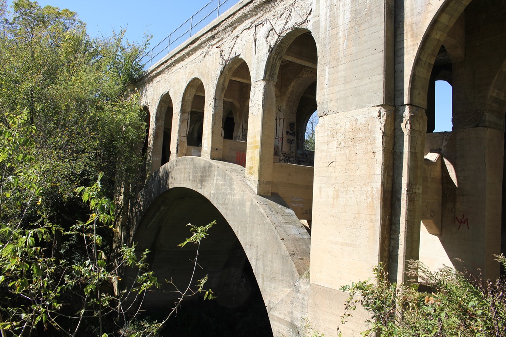
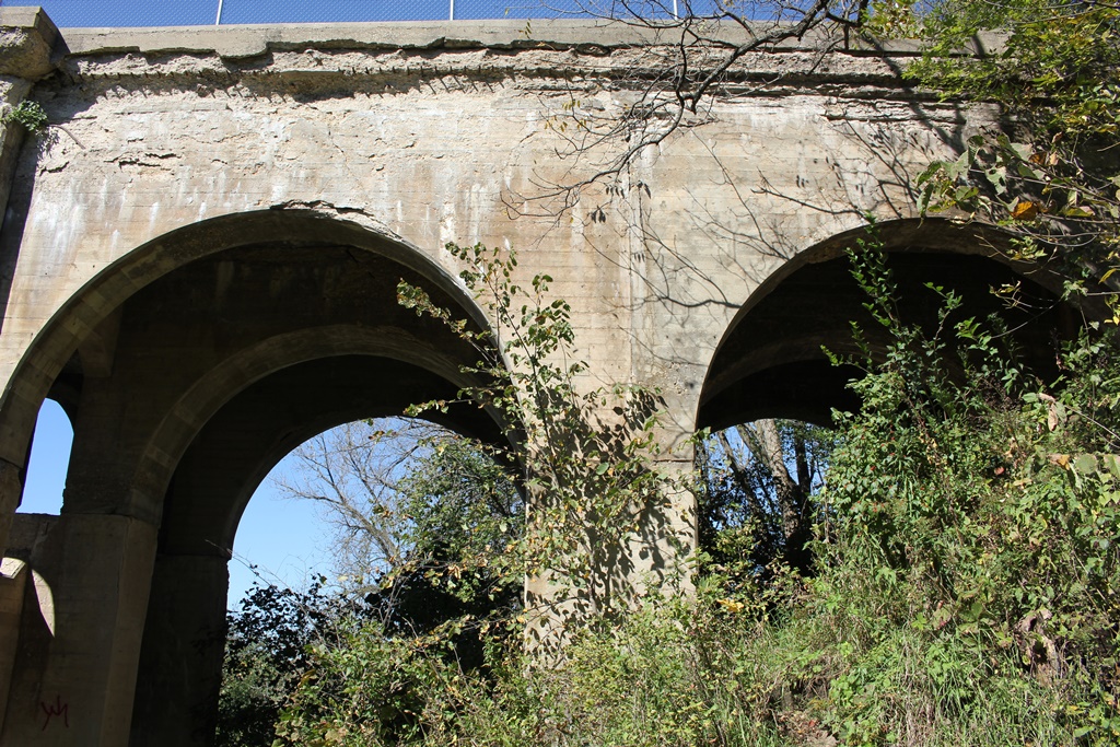
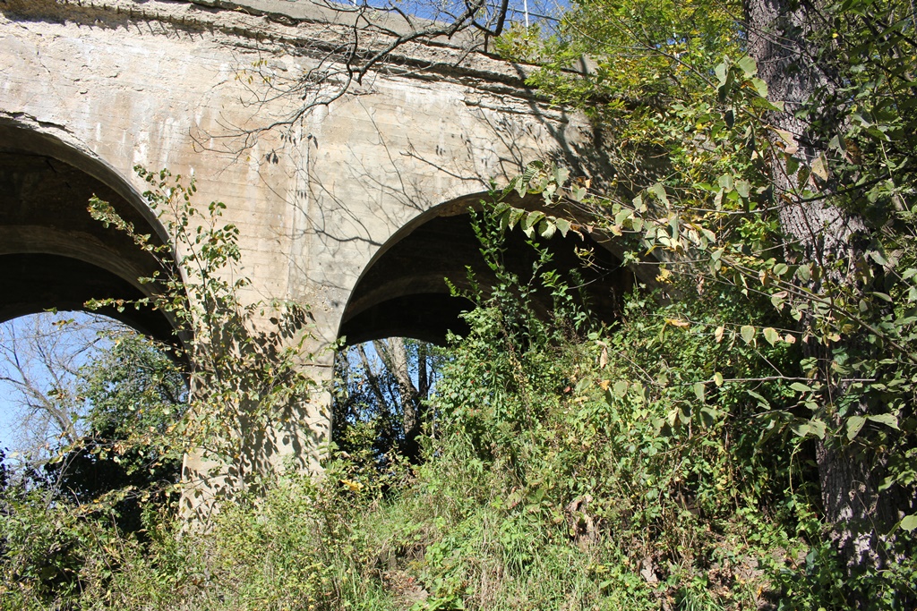
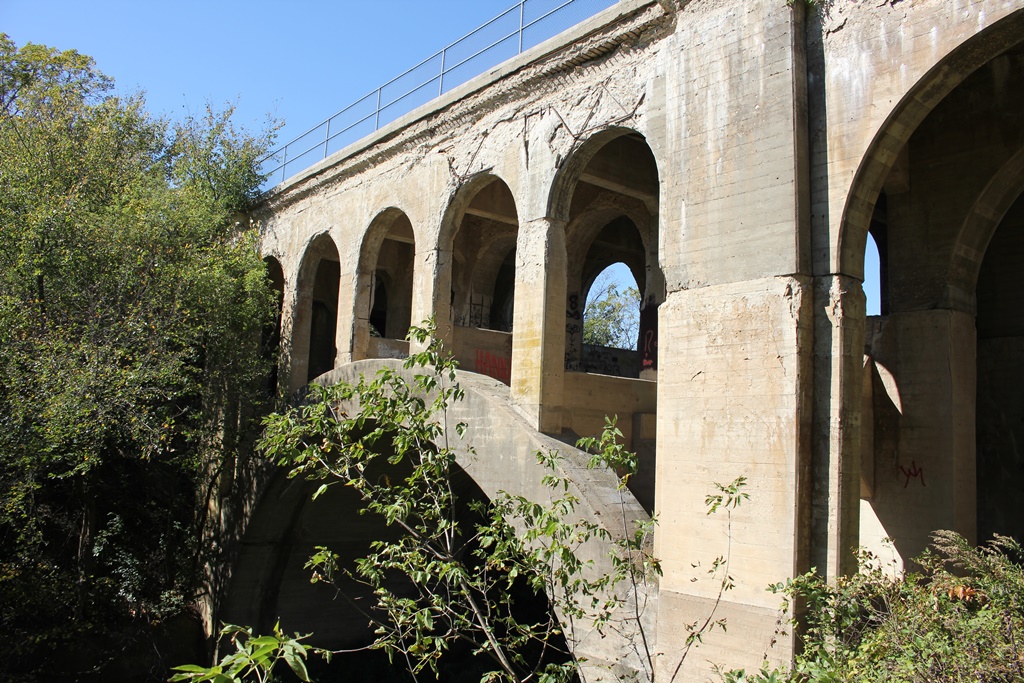
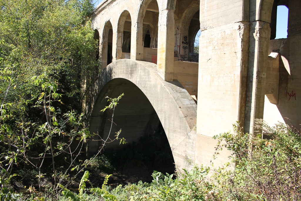
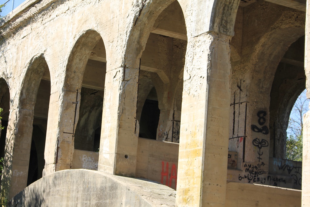
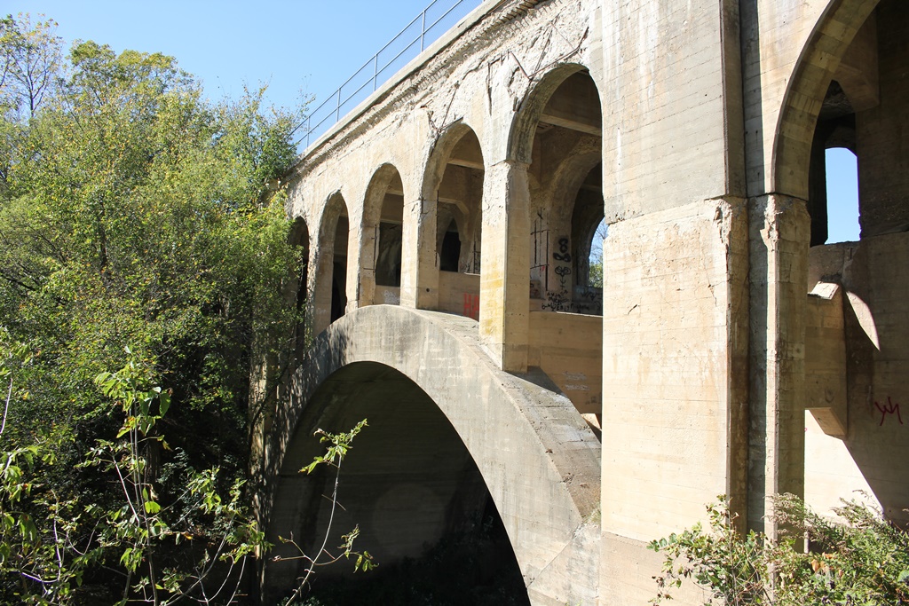
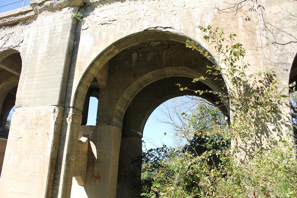
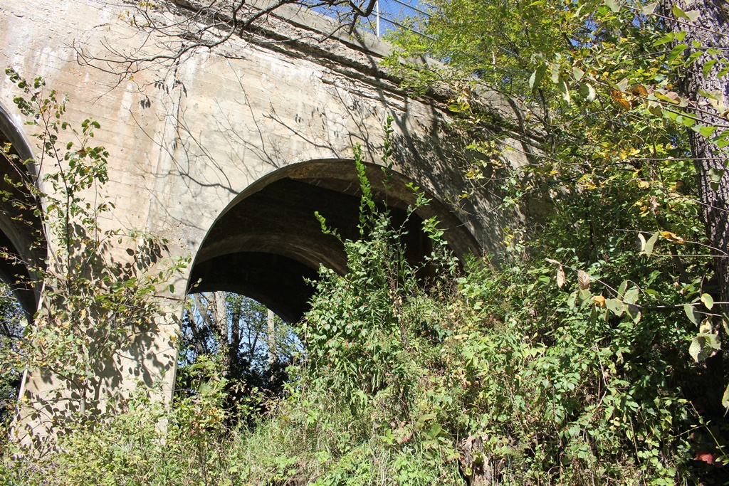
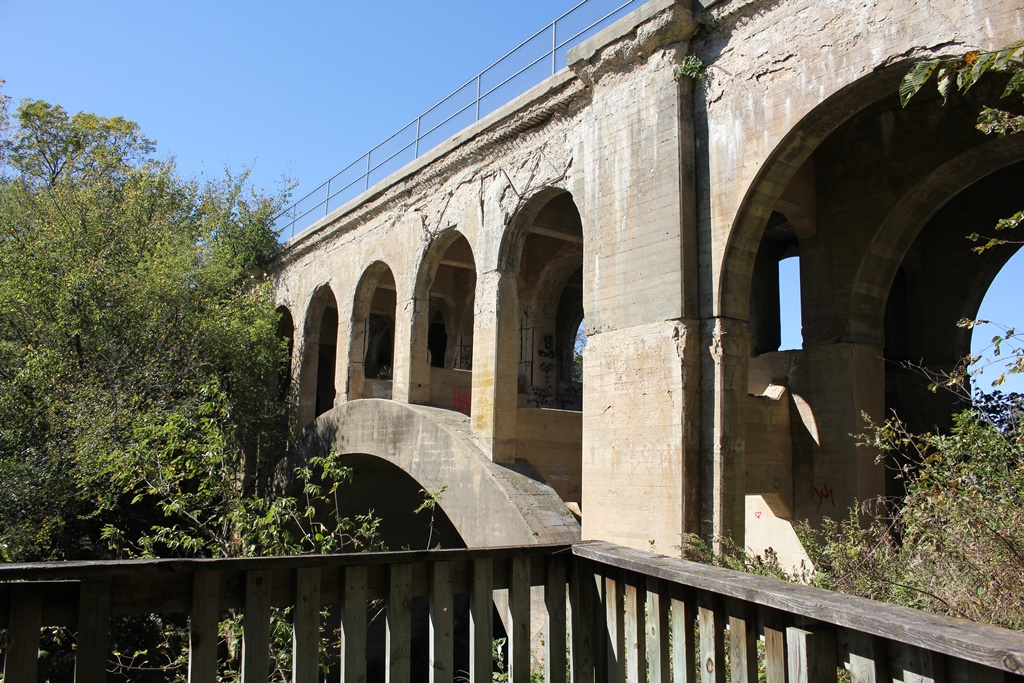
This massive concrete arch bridge crosses over Clear Creek just west of Rhodes.
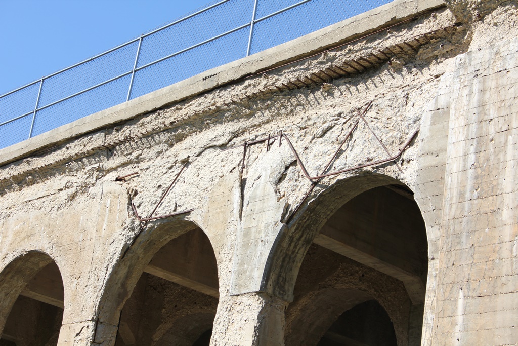
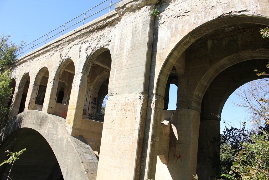
Built in 1913, the open spandrel arch structure is the only like it along Iowa railroads. Another near Richland, Iowa used to exist but was removed in the 1940s for unknown reasons.
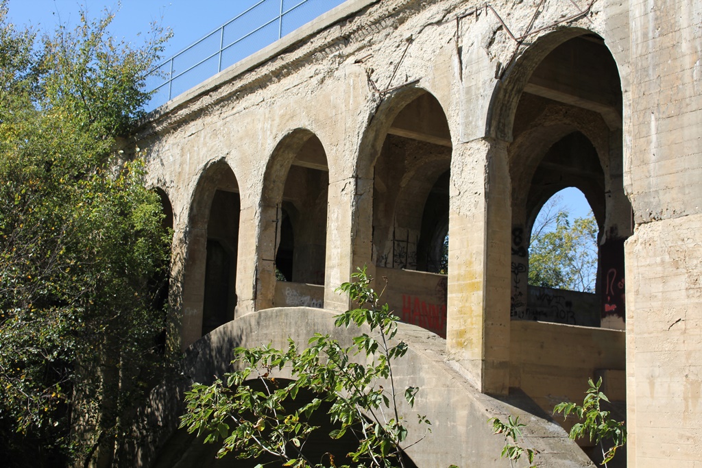
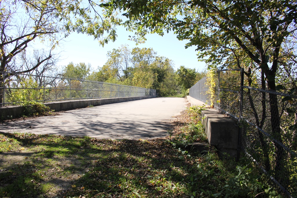
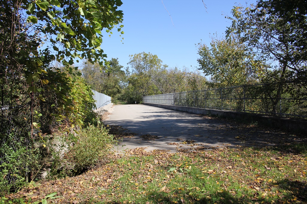
Today, this large bridge is the center piece of the Heart of Iowa Nature Trail, which utilizes the former rail bed.
The arch features a large 60 foot main span, which is approached by closed spandrel arches on either side.
Overall, the bridge remains in fair condition. A significant amount of deterioration has occurred on the arch.
To counter this, Marshall County should consider doing a full restoration of the arch, as well as trimming much of the vegetation surrounding the bridge.
The author has ranked the bridge as being highly significant, as a demonstration of an open spandrel concrete arch in the region.
The photo above is an overview. The bridge can be accessed from the trail above.